Introduction: The Problem With Traditional Home Building
You’ve finally done it – secured that perfect block of land. The canvas for your dream home. But now comes the hard part: How do you turn this patch of dirt into the home you’ve always imagined without costly mistakes?
Most Australians approach building with a mix of blueprints, blind faith, and crossed fingers. They approve designs on paper, only to discover during construction that:
The master bedroom gets no morning sun
The driveway is steeper than anticipated
Council rejects plans due to shadowing on the neighbor’s property
This trial-and-error approach costs the average Australian homeowner $42,000 in avoidable rework and variations (Australian Construction Association, 2023). But there’s a better way.
At 3dFlats, we’ve pioneered a 3D GIS visualization process that eliminates the guesswork from home building. Here’s exactly how our technology transforms your empty block into a photorealistic dream home before construction begins – and why every savvy landowner in Australia should use it.
Stage 1: Mapping Your Land’s DNA – The Foundation of Smart Design
Why This Matters More Than You Think
Every block has its unique personality – the gentle slope you didn’t notice during inspection, the protected tree near the boundary, the subtle drainage patterns that emerge during heavy rain. Traditional surveying captures some of this, but GIS-powered 3D mapping reveals everything.
Our process begins with advanced drone and satellite scanning that captures:
Topography: Every contour and slope of your land (critical for foundation work)
Vegetation: Mature trees and root systems that might impact construction
Underground services: Water, gas, and electricity lines
Zoning boundaries: Precisely where you can and can’t build
The Game-Changing Difference
Consider the case of Michael and Sarah in Newcastle. They purchased what appeared to be a flat block, only our 3D GIS scan revealed a 1.4m elevation change across the site. This early discovery allowed their architect to rotate the home design, saving $18,000 in earthworks and creating a stunning split-level design that capitalized on the natural slope.
*”We would have spent thousands fixing this mid-construction if not for the 3D mapping,”* Michael noted. “Instead, we turned what could have been a problem into our home’s best feature.”
Stage 2: Bringing Your Vision to Life – Where Creativity Meets Precision
From Sketch to Photorealistic Model
This is where the magic happens. Whether you’re working with an architect’s plans or starting from scratch, our team integrates your vision with the real-world conditions of your block.
Here’s how it works:
Design Input: Share your sketches, Pinterest boards, or architect’s drawings
3D Modeling: We create multiple design options that respect your land’s unique features
Virtual Walkthroughs: Experience your future home from every angle before finalizing
The Power of Seeing First
Take the example of the Patel family in Melbourne’s outer suburbs. They loved their architect’s modern farmhouse design but couldn’t visualize how it would sit on their bush block. Our 3D GIS integration revealed:
The proposed deck would require removing a protected native gum tree
The roofline would block winter sun to their vegetable garden
The garage placement made the driveway dangerously steep
After three virtual revisions, they landed on a design that:
Preserved all significant trees
Maximized northern sunlight
Created a gentler driveway gradient
“We made all our mistakes on the computer instead of in concrete,” Mrs. Patel remarked.
Stage 3: The Perfect Fit – Tailoring Your Home to Your Land
Beyond One-Size-Fits-All Designs
Most display homes and stock plans are designed for hypothetical flat blocks. Reality is rarely so accommodating. Our 3D fitting process ensures your home:
Follows the natural contours of your land (reducing earthworks)
Preserves the site’s best features (mature trees, views, natural light paths)
Complies with all council regulations
Real-World Example: The Coastal Challenge
A Byron Bay couple wanted to build their retirement home on a spectacular but challenging oceanfront block. The challenges:
Severe coastal erosion zone restrictions
Salt-laden winds from the northeast
Tight space between two protected pandanus trees
Using our 3D GIS modeling, we:
Tested 7 different home orientations virtually
Simulated wind patterns to optimize outdoor living spaces
Created a design that nestled perfectly between the trees
The result? A stunning home that:
Required no vegetation removal permits
Positioned the pool in a wind-protected zone
Maximized ocean views while meeting strict coastal codes
Stage 4: Council Approval Made Certain – Shadow Analysis That Prevents Headaches
Why 40% of DA’s Get Delayed (And How to Avoid It)
Council rejections often come down to:
Shadow impact on neighboring properties
Non-compliance with solar access requirements
Misjudged building envelopes
Our 24/7 sunlight simulation technology maps exactly how shadows from your home will fall:
In different seasons
At various times of day
Across neighboring properties
Case Study: The Inner-City Infill
A Sydney developer planned to build a duplex on a tight Surry Hills block. Initial designs were rejected because shadows would affect a neighbor’s solar panels.
Using our system, we:
Identified the exact problem areas
Adjusted the roofline and setback
Provided council with certified shadow studies
The revised plans were approved in just 11 days, saving an estimated $72,000 in holding costs.
The 3dFlats Advantage: Why This Changes Everything
For Homeowners
Save 5-15% on construction costs by eliminating errors early
Reduce stress by seeing exactly what you’re getting
Speed up approvals with council-ready documentation
For Builders
Fewer variations with client-approved 3D plans
More accurate quoting with precise terrain data
Faster turnaround with pre-validated designs
For Architects
Test more design options in real-world conditions
Deliver better results with integrated GIS data
Win more clients with stunning 3D presentations
How to Get Started With Your 3D Home Journey
Option 1: The Full Service (For New Builds)
Site survey: We map your block with GIS technology
Design Integration: Merge your plans with real-world conditions
Virtual Testing: Explore and refine your home in 3D
Council Prep: Get all required compliance documentation
Option 2: The Renovator’s Package
Existing home scans
Extension/renovation modeling
Shadow and solar impact reports
Option 3: The DIY Designer
Upload your own plans for 3D conversion
Basic sunlight and terrain analysis
Affordable starting packages
Conclusion: Building Certainty in an Uncertain Process
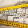
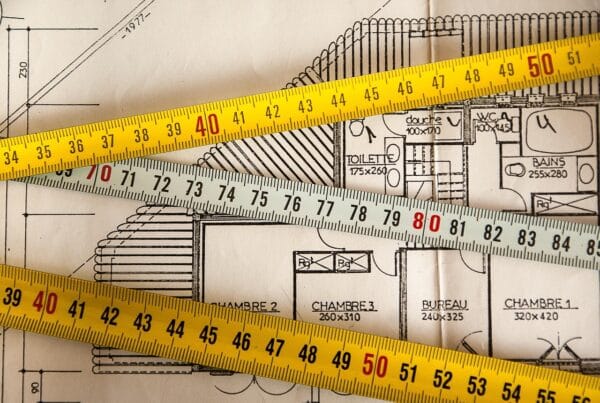
The old adage “measure twice, cut once” has never been more relevant. In an era where construction costs are soaring and council regulations tightening, 3D GIS visualization is no longer a luxury – it’s essential insurance for your property investment.
As one of our clients put it: “We didn’t just get a house design – we got the confidence that comes with seeing exactly how our dream would work in the real world before we committed.”
Your next step?
Register on 3dFlats today for a free trial
Visit our website to see sample 3D transformations
Because in today’s market, seeing truly is believing – before you build.